Badger sett locations at Wytham

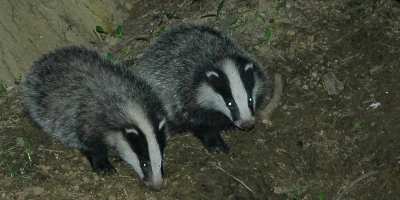
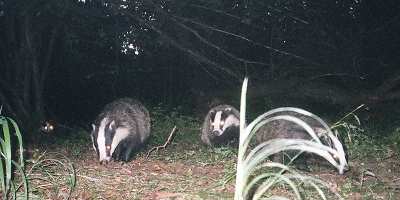
At Wytham Woods researchers at the Wildlife Conservation Research Unit, Department of Zoology, University of Oxford (WildCRU) have been studying Eurasian badgers (Meles meles) in great detail since 1987, building on previous work stretching back to the early 1970s. The foundation of the Badger Project at this site has been a commitment to monitoring every individual in the population from 'womb-to-tomb', providing comprehensive data on the ecology and behaviour of the entire population.

The dataset resulting from the long-term badger study at Wytham Woods is possibly the most detailed and complete for any carnivore population in the world. The study has shown that badgers have an intriguing social system that defies conventional explanation. Most carnivores are solitary, and those that do live together in groups generally display complex co-operative behaviour. Badgers, however, live in groups but do not forage together or collaborate in defending their territory. Instead their grouping hinges on the distribution of their food - primarily earthworms in the UK.

The study has also discovered that badger survival and cub productivity may be affected by climate change. Researchers have live-trapped, marked and monitored the entire study population regularly since 1987, building on earlier surveys stretching back to 1973. Using a combination of a live-capture-release programme, radio-tracking and video surveillance, it has been possible to monitor badger life-histories and behaviour. To-date there are records for over 1300 individuals on file, amounting to almost 8000 unique trapping events.
Individual activity: Badger terminology

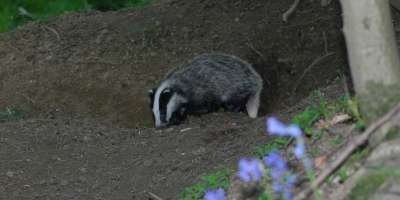
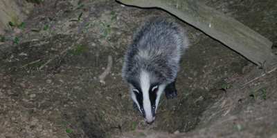
A badger social group lives in a semi-discrete geographical area termed a territory. A badger’s ‘house’ is termed a sett, which consists of interconnected tunnels and chambers dug into the ground. Badgers from one or more setts can make up a badger social group. Chris Newman put it very succinctly: “it's more reminiscent of a single-family homestead where the kids build a starter home in the garden and granny has a flat next door”!
As badgers don't defend their territory, the term territory doesn't fully comply with the strict definition when applied to badgers, so some authors talk about social group ranges instead. In this exercise, we will use geographical data to delimit badger territories.
You can find out more about Eurasian badgers at the BBC Wildlife Finder site, and about the Badger Project at Wytham at Wildlife Conservation Research Unit.
Individual activity: What environmental variables influence sett location at Wytham?
How would you go about surveying the location of setts in the woodland?
-
Start writing a short protocol explaining your chosen method of surveying the location of setts. Keep in mind: the size of the woods; the time you have to conduct the survey; whether you will conduct a systematic survey or not (that doesn’t miss out areas); whether you are doing it on your own or with other surveyors; whether you will need any equipment; health and safety considerations. This will be an ongoing compilation, so that by the time you reach the end of this practical, you should have one Research document which you can upload to the Badger forum.
Once you have decided on the protocol for locating the setts, think about the environmental variables you would record at each sett. We are giving you a helping hand here, as previous research by Macdonald et al. in 2004 investigated whether soil texture (clay, sand or limestone), altitude, aspect or habitat cover were key variables in sett distribution at Wytham. What other variables might you record for each sett?
-
Now design the data recording sheet that you’ll use for the field survey at Wytham. The data recording sheet must take into account the data needed to record the location of each badger sett, as well as the environmental variables recorded at each sett. Add the data recording sheet to your ongoing Research document.
-
Now go into the Sett location map and click on each badger sett. You’ll find that most of the data, with the exception of location, have already been recorded for you, making your job a lot quicker than a real field survey.
Each pop-up box contains data unique to that sett on: altitude (metres asl); aspect (north= N, south= S, east= E, west= W, and flat= flat ground); soil texture (clay, sand, limestone); and whether the sett is close to an oak tree or not.
Fill in your data recording sheet and save the data in a data matrix or Excel file- these are your results. Add the results to the Research document, and write a short paragraph on your findings. What seems to influence sett location at Wytham Woods?
Individual activity: An interesting back-of-the-envelope calculation
The Wytham badger surveyors pointed out that “if the survey transects are 4 metres wide, that represents walking along 2500 metres (25 x 100 metres) of transect per hectare. Multiply that figure by the total area of Wytham Woods to be surveyed (say, 400 hectares), and that would mean walking along 1000 kms of transect!”


